We are selling the Source code of this Native iOS- Swift, Android – Java and Windows .NET C# advanced mapping application with Catalog JSON Loading of map configuration. Over 2.5 years of development went into this application! The Map Engine is powered by OpenLayers 6x JavaScript WebGL in a webview with webserver and all local resources which means you can have a front-end web developer work on map features paired with your mobile developer for rapid agile development!


App Features
Delivering products and services designed to give you a more convenient and reliable experience.
Digitizing/Drawing features and capturing attributes
The app supports data creation and editing digitizing / drawing vector features, Analysis tools like measure distance and area, map swipe, getting elevation, viewing attribute tables.
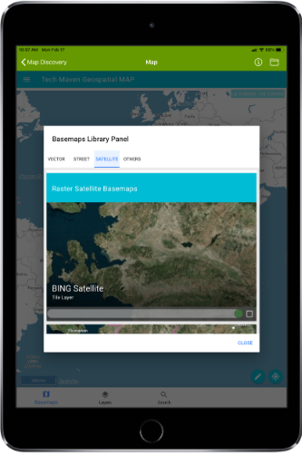
Supports Offline Tiles
supports Offline Tiles and 3D Models and 3DTIles.
Document Viewer
The app supports document viewer.
XYZ Raster Tiles and OGC WMS Server Downloading to GPKG
The app includes tile downloading module is able to create offline geopackage raster tiles from online basemaps/tile servers
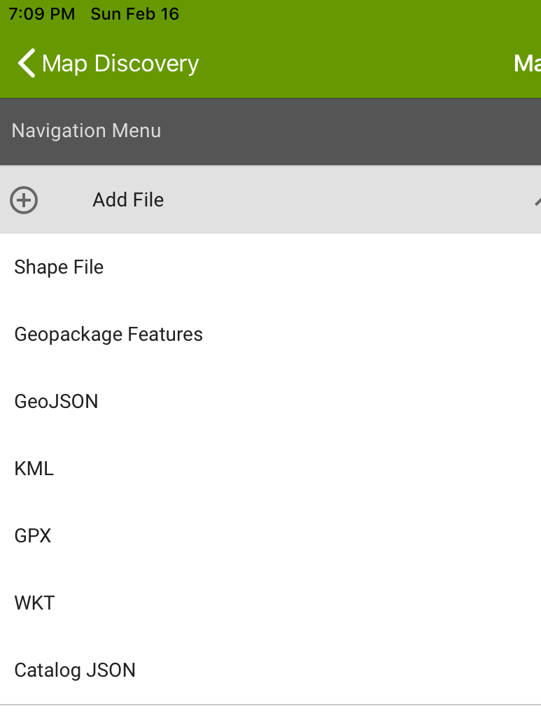
JSON Data Catalog
The app has a data catalog JSON format feature that allows for configuring online mapping services (ESRI MapServer, ESRI ImageServer, ESRI FeatureServer, OGC WMS, OGC WMTS Tiles,XYZ/TMS Tiles,OGC WFS).
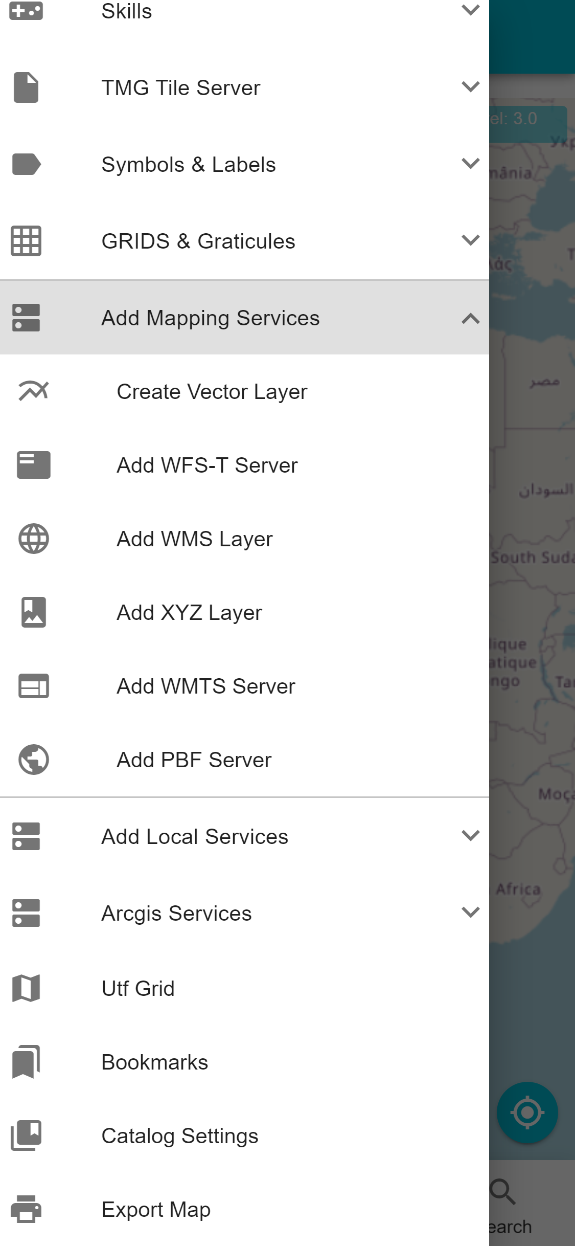
Data and online mapping services
The app supports data and online mapping services.
Dynamic Efficient Rendering of large GPKG Vector Features to Raster Tiles with styling
The app supports dynamic efficient rendering of large GPKG Vector Features to Raster Tiles with styling
2D Advanced Map Viewer
It has 2D Advanced Map Viewer – OpenLayers and 3D Scene /Perspective View with ThreeJS.
In-app Vector Tiling and advanced display of local vector data
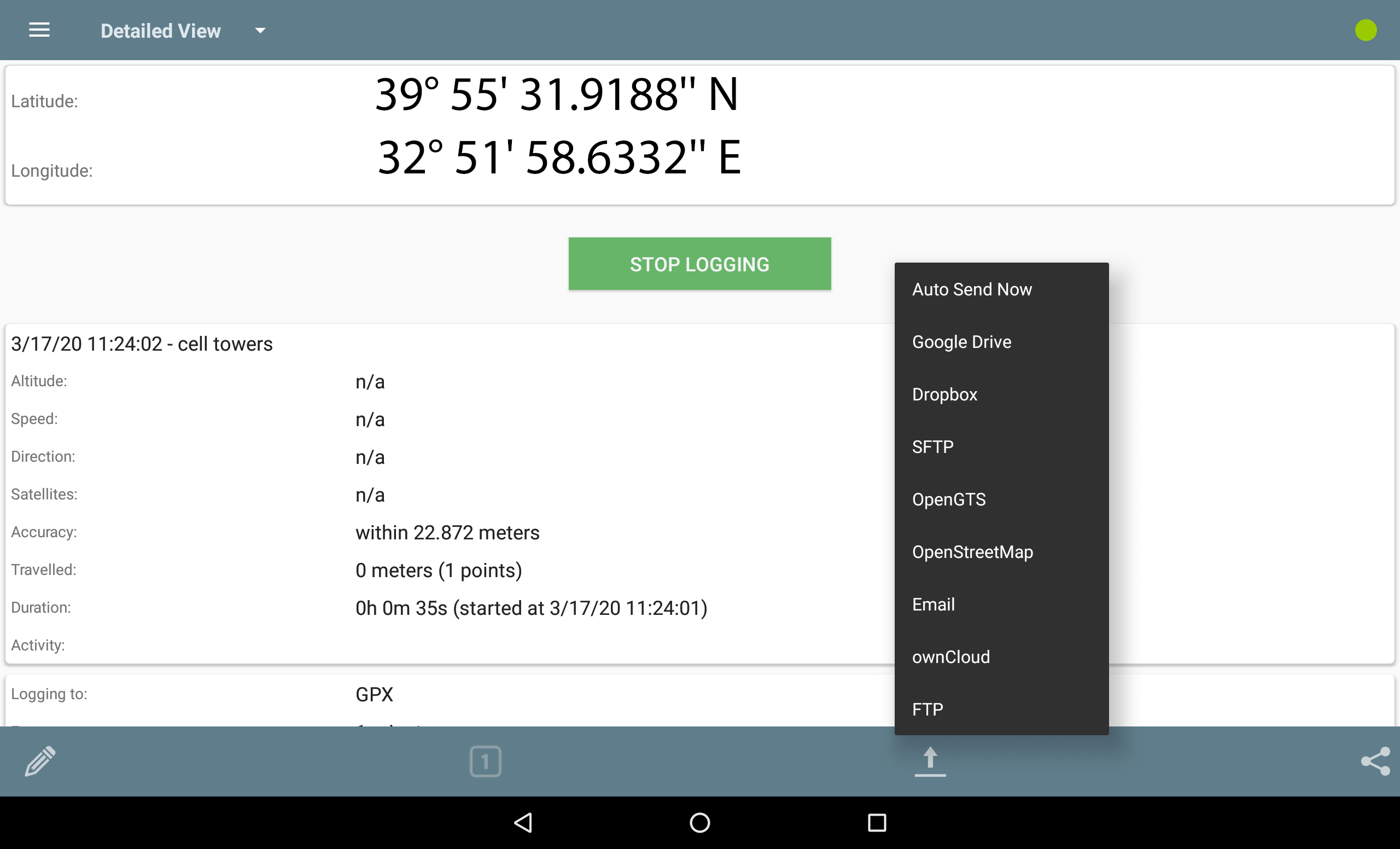
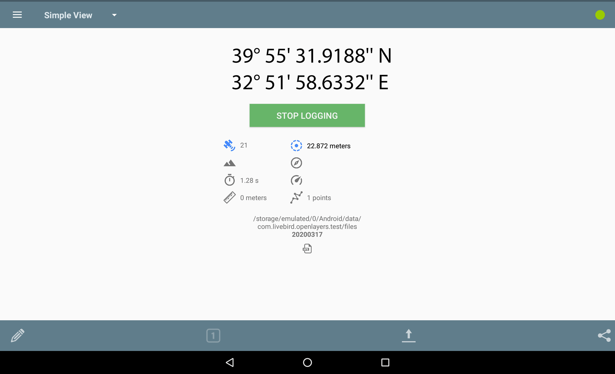
GPS Tracker/Recording
A GPX Recorder module is included with the app and it provides advanced functionality for track and breadcrumb recording and playback.
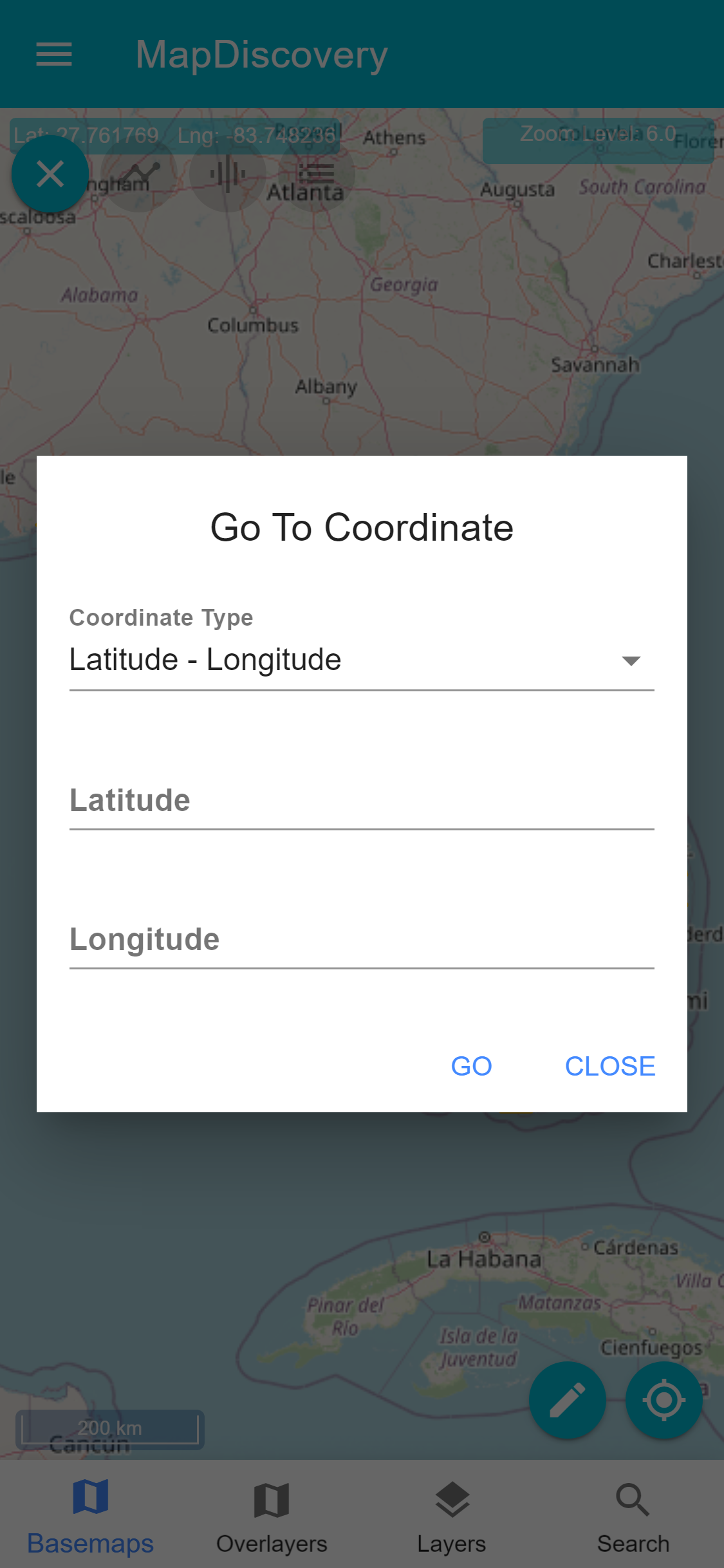
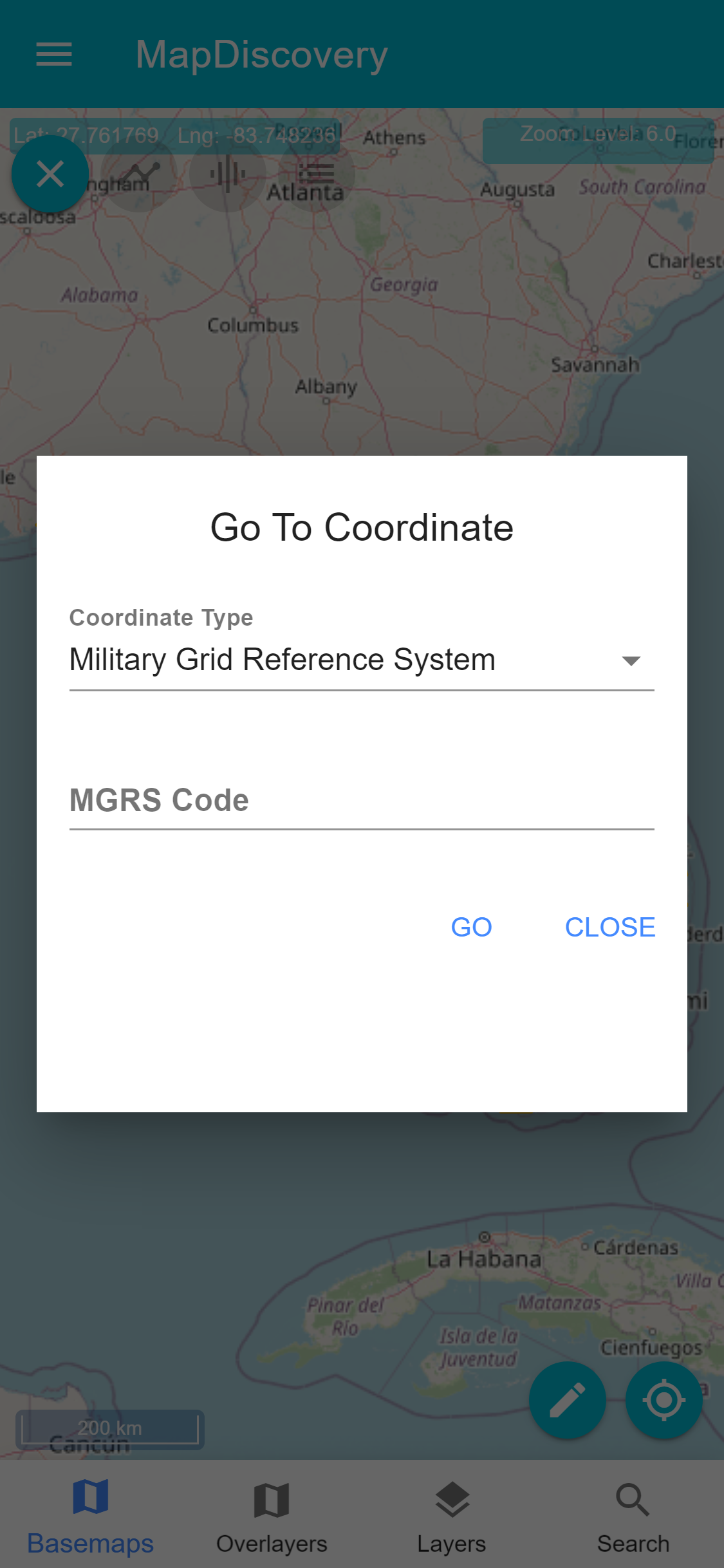
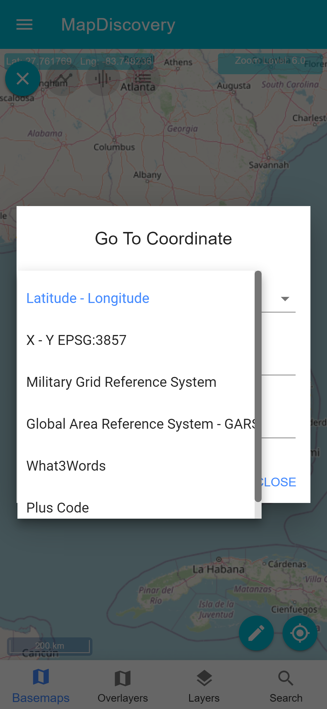
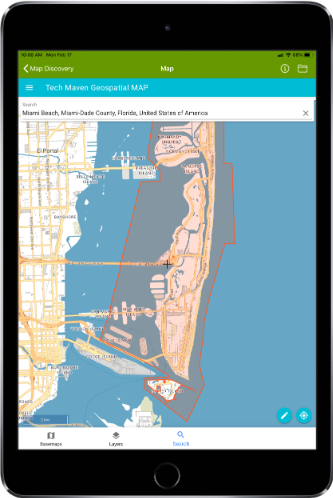
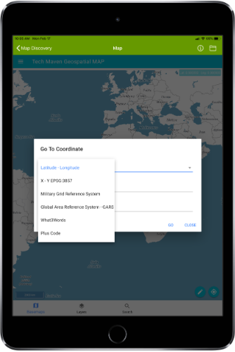
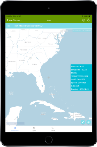
GO TO COORDINATES
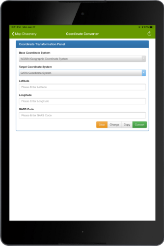
The app is very customizable to your needs the units of measure can be changes as well as Display of Map Coordinates ( Latitude and Longitude, MGRS, GARS) and Scale bar
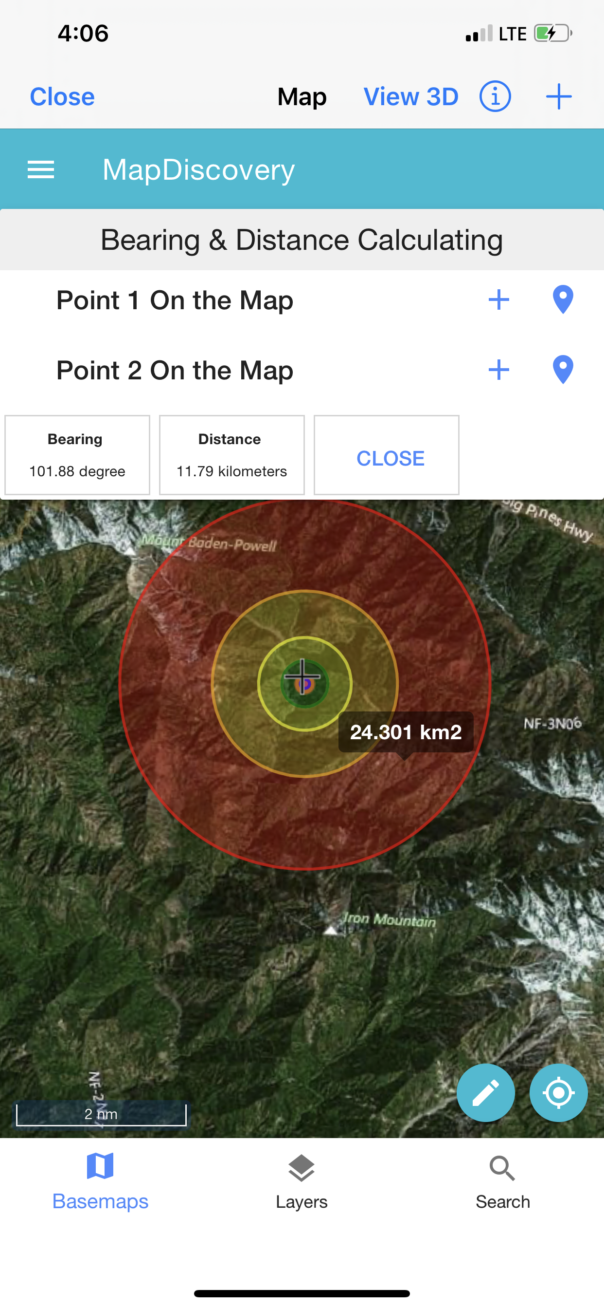
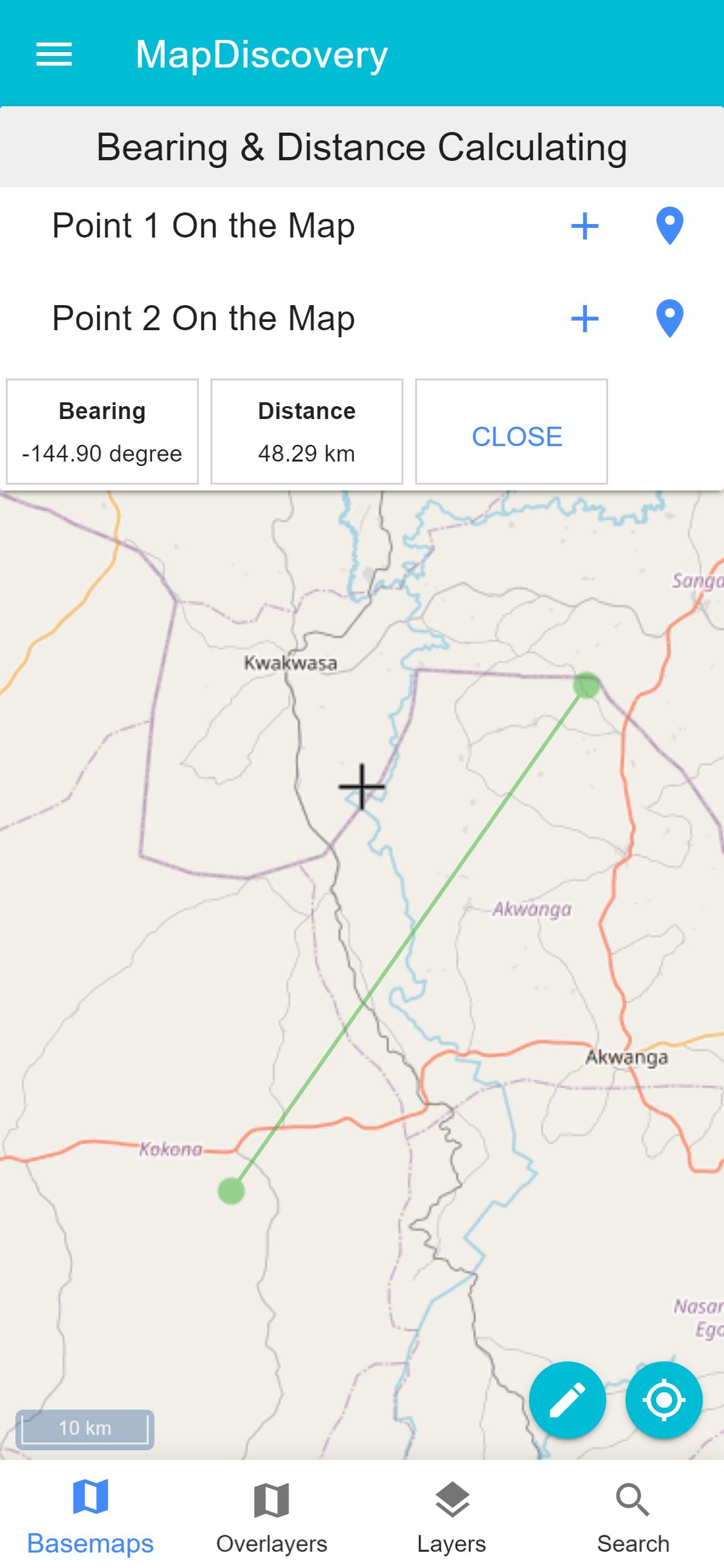
BEARING & DISTANCE
The app is very customizable to your needs the units of measure can be changes as well as Display of Map Coordinates ( Latitude and Longitude, MGRS, GARS) and Scale bar
Marker Symbols & Clustering
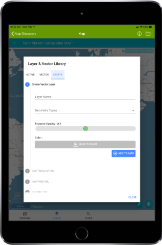
Create Vector Data Digitize
The app supports data creation and editing digitizing/drawing vector features.
Coordinate Converter
A coordinate converter tool is available.