
Windows Map Discovery Application
Highly Advanced 2D Mapping Microsoft Windows app with support for online mapping services

$4.99
Purchase includes one install
If you are interested in a license key valid for multiple installs or multiple apps
please contact us →
Salient Features
COG Cloud Optimized GeoTIFF
The app supports loading internet and local COG files
GeoPackage Vector Features
GIS Vector Data in SQLite OGC GPKG Vector Features
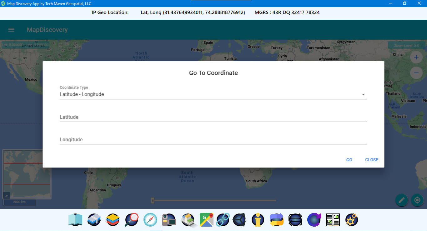
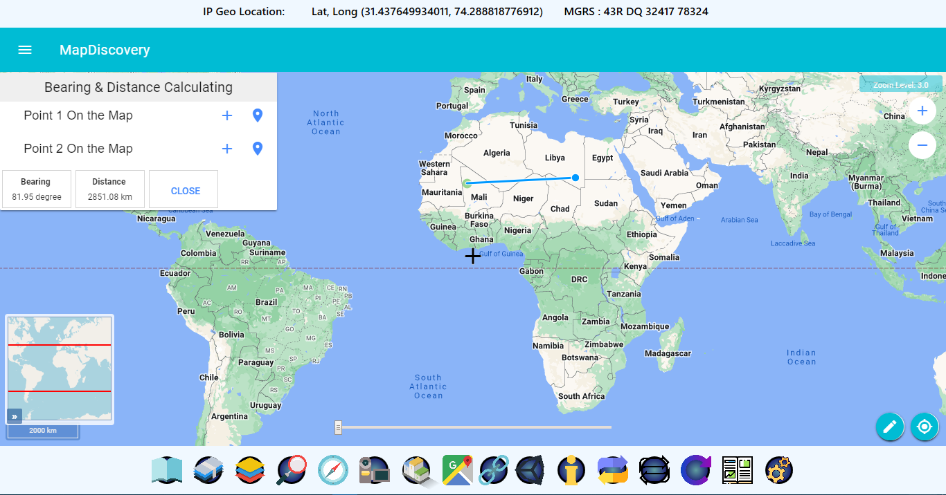
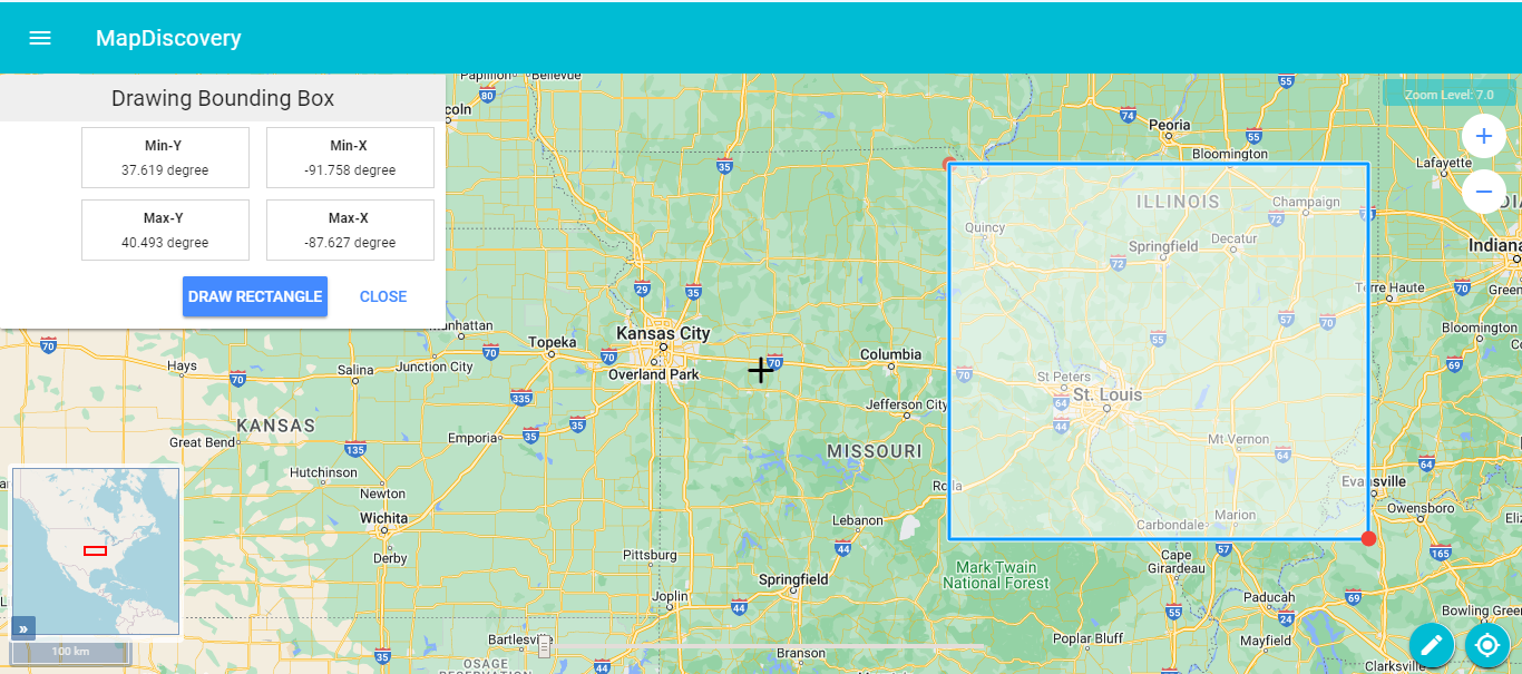
Coordinate Converter
A coordinate converter tool is available
2D ADVANCED MAP VIEWER
It has 2D Advanced Map Viewer – OpenLayers and 3D Scene /Perspective View with ThreeJS. In-app Vector Tiling and advanced
JSON Data Catalog
The app has a data catalog JSON format feature that allows for configuring online mapping services (ESRI MapServer, ESRI ImageServer.
Online Mapping Services
The app supports data and online mapping services.
BaseMap Picker
BaseMap Picker for raster tiles and vector tiles with stylesheets, as well as connect to basemaps, OGC WMS, XYZ tile servers. The default base is Open Street Map Vector tiles with different stylesheets.
Add Vector Data
Users are able to load GIS mapping data: mbtiles, gpkg, Shapefiles (zipped), KML, GPX, GeoJSON.
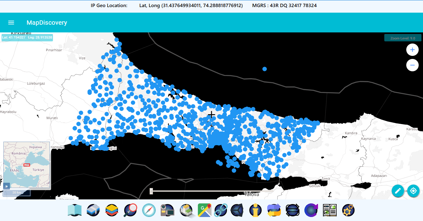
Native GeoLocation Widget
The app is able to show native geolocation information via a widget over the map.
Application’s Quick Look
Basemaps
Load multiple basemaps on the maps already provided by the application
Catalog Data Loading
Catalog Data loading to quickly configure access to online mapping services and online files (geojson, csv, gpx)text
Google Maps 2D / 3D
The application supports the google maps 3d and 2d view. You can see the center cursor view on the google maps.
Bing Maps 2D / 3D
The application supports the bing maps 3d and 2d view. You can see the center cursor view on the bing maps.
3D Viewer
Point the center of the map to see the 3d buildings, 3d mountains and 3d views of that area.
User Links
User can open pre defined urls and also add its specific urls that will be saved for future use.
Load Vector Data
Users can load the vectoe data i.e. geojson, gpkg, kml, shapefile, gpx, geo tiff etc.
Tile Server Tile Rendering
Windows tile server can be used to serve local tiles, Map Discovery can provide interface where those offline tiles can be seen using catalog builder.
We can easily add support for :
- AVL Live Location Tracking with dashboard
- Geofencing with notifications (location tracking and geofencing can be self hosted or as subscription but no third party service is required)
- Access to Secured /Private mapping services AGOL/ArcGIS Portal Content or GeoServer Content
- Integration with existing systems and databases and API’s, work management, asset management other systems.
- Other live data (OGC SOS, OGC Moving Features, ADS-B, AIS, etc)
- We are a full service full stack Geospatial development firm and can easily add custom capabilities.
GEO DATA SERVER
WINDOWS & LINUX INSTALLABLE APPLICATIONS
Serves vector local GIS vector data (ESRI Shapefile, GeoJSON, KML, GPKG Vector features SQLite database and PostGIS /PostgreSQL Database tables) as:
- PBF Vector Tiles-http://IPaddress:port/dataset/{z}/{x}/{y}.pbf
- GeoServices REST API FeatureServer-http://IPaddress:port/dataset/featureserver