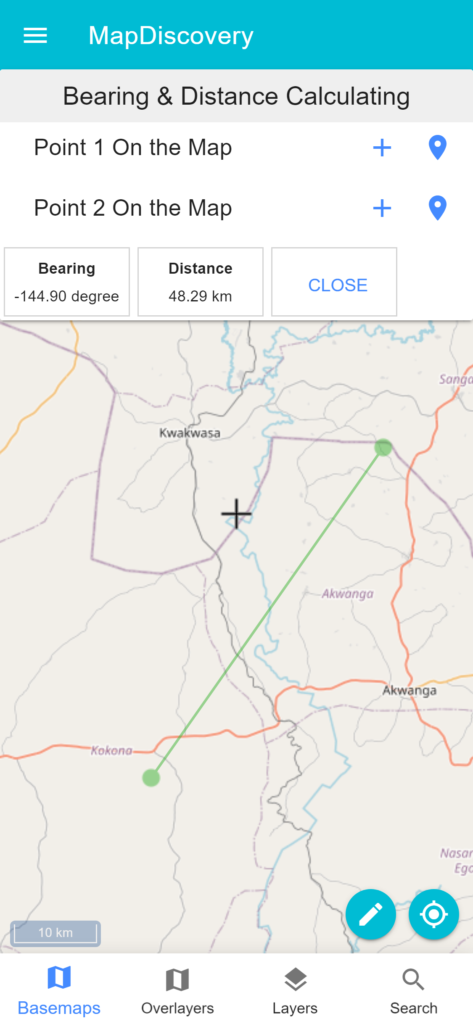
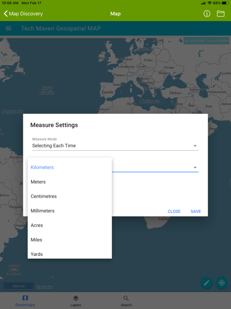
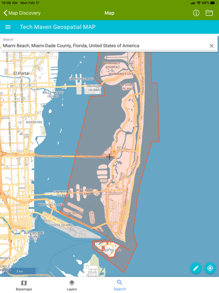
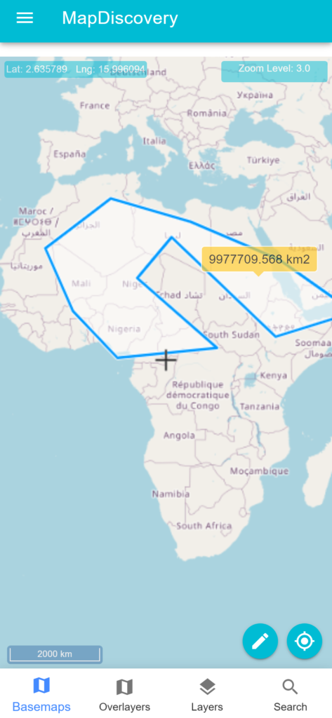
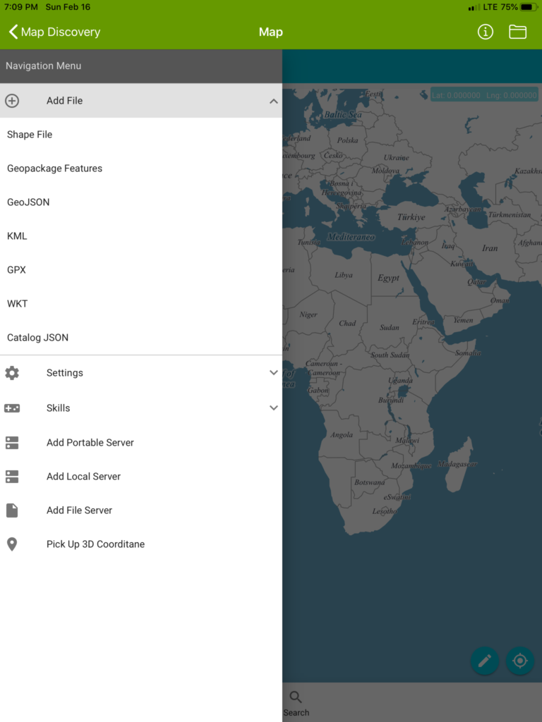
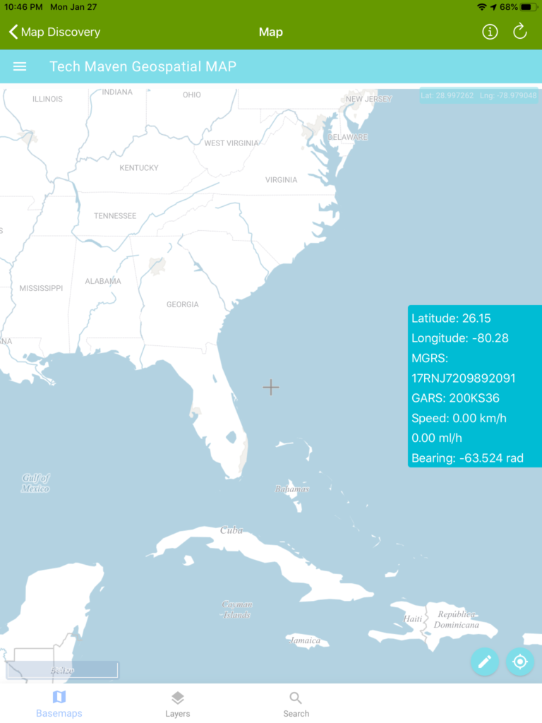
Features Bearing and Distance Calculation Measure Linear and Area Search OSM The default base is Open Street Map Vector tiles with different stylesheets Digitizing/Drawing features and capturing attributes The app supports data creation and editing digitizing / drawing vector features, Analysis tools like measure distance and area, map Add Vector Data Users are able to load GIS mapping data: mbtiles, gpkg, Shapefiles (zipped), KML, GPX, GeoJSON. Native GeoLocation Widget The app is able to show native geolocation information via a widget over the map. « Previous 1 … 3 4 5 6 Next »